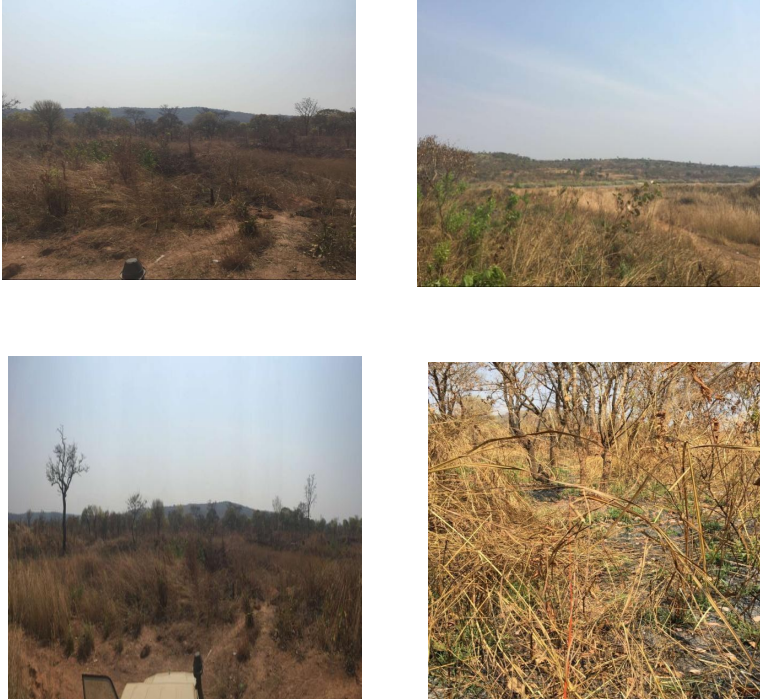
Test purpose: The working area has a thick covering layer, and it is difficult to find the fault or abnormal area simply from the geological structure. Geophysical exploration becomes the most effective method. By measuring the fault and finding the fault zone, gold mines can be found. Working area: Cameroon, Africa, the measurement site environment is shown in Figure 2; measurement pole distance: 60 meters; point distance: 5 meters; line distance: 5 meters; measurement direction is east-west, and the total number of
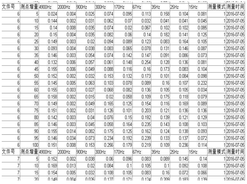
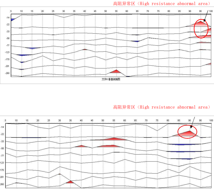
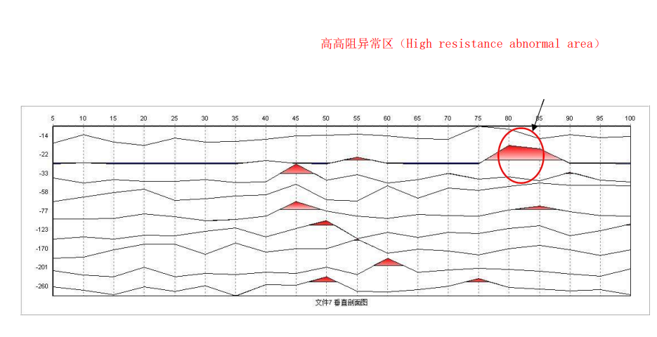
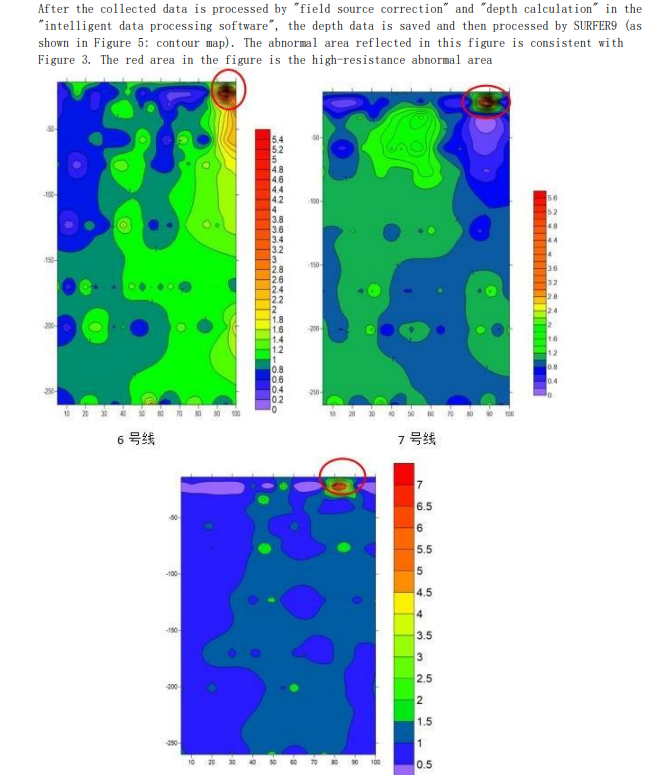
measurement lines: 3. The data collected by the instrument (Figure 3) is processed by "Aidu Intelligent Data Processing Software". Figure 4 is a vertical profile, where the horizontal axis represents the measuring point number, the vertical axis represents the depth, and the red area is the high-resistance area, that is, the possible mineralization area. The depth of point 19 (95 meters) on Line 6 is about 22 meters, the depth of point 18 (80 meters) on Line 7 is about 22 meters, and the depth of point 17 (85 meters) on Line 8 is about 22 meters.